EMBODYING A NEW WAY FORWARD.
WE ARE CREATING A FUTURE FOR PUBLIC-PRIVATE COLLABORATION.
Red River Valley Alliance’s role:
The Stormwater Diversion Channel and Associated Infrastructure.
LOOKING BACK…
Red River Valley flood risk increasing
The Red River Valley is one of the most flood-prone areas in the U.S.The Red River flooding in 1997 demonstrated the devastating effects a disaster can have on a single metro area. Damages in Grand Forks, North Dakota, and East Grand Forks, Minnesota amounted to $3.5 billion.

Extreme precipication, two inches or more has increased in frequency since 1990 and has worsened further since 2015
The Fargo-Moorhead Metropolitan Area Flood Management Project
Lorem ipsum dolor sit amet, consectetur adipiscing elit. Curabitur lacinia libero id luctus tempor. Morbi euismod consectetur scelerisque. Donec ut ultricies dui,
Planning ahead..
Investing together to prevent costly damage
Lorem ipsum dolor sit amet, consectetur adipiscing elit. Curabitur lacinia libero id luctus tempor. Morbi euismod consectetur scelerisque. Donec ut ultricies dui,
Now, the community is on track to have permanent, reliable flood protection by 2027
STORM WATER DIVERSION CHANNEL
Red River Valley
Alliance’s Role in the project
Red River Valley Alliance is in the process of building the Fargo-Moorhead Area Diversion channel. The Fargo-Moorhead Metropolitan Area Flood Risk Management Project represents the first United States Army Corps of Engineers (USACE) public-private partnership (P3) and one of the first large-scale ESG-focused P3 transactions in the United States of America.
The project is the first pilot project under the agency’s Revolutionize USACE Civil Works initiative, which aims to demonstrate the possibility of novel delivery methods that effectively lower project costs and construction time.

Lorem ipsum dolor sit amet, consectetur adipiscing elit. Curabitur lacinia libero id luctus tempor.

Lorem ipsum dolor sit amet, consectetur adipiscing elit. Curabitur lacinia libero id luctus tempor. Morbi euismod consectetur scelerisque. Donec ut ultricies d
project by the number


channel location
Red River Valley Alliance is contracted to construct and maintain the Stormwater Diversion Channel and Associated Infrastructure (SWDCAI). This includes a 30-mile stormwater diversion channel, a diversion outlet, and aqueducts on the Maple and Sheyenne Rivers.
The project scope will contain:
– Fourteen drainage inlets
– Three railroad crossings
– Two interstate crossings
– Twelve county road crossings
Lorem ipsum dolor sit amet, consectetur adipiscing elit. Curabitur lacinia libero id luctus tempor.
Track the progress of our project on our progress page or read our latest blog.

LOOKING BACK…
Red River Valley flood risk increasing
The Red River Valley is one of the most flood-prone areas in the U.S.The Red River flooding in 1997 demonstrated the devastating effects a disaster can have on a single metro area. Damages in Grand Forks, North Dakota, and East Grand Forks, Minnesota amounted to $3.5 billion.
The Fargo-Moorhead Metropolitan Area Flood Management Project
Integrating more public-private partnerships can have positive impacts for all governmental projects and allow for more economic and efficient execution of projects.
STORM WATER DIVERSION CHANNEL
Red River Valley Alliance’s Role in the project
Red River Valley Alliance is in the process of building the Fargo-Moorhead Area Diversion channel. The Fargo-Moorhead Metropolitan Area Flood Risk Management Project represents the first United States Army Corps of Engineers (USACE) public-private partnership (P3) and one of the first large-scale ESG-focused P3 transactions in the United States of America.
The project is the first pilot project under the agency’s Revolutionize USACE Civil Works initiative, which aims to demonstrate the possibility of novel delivery methods that effectively lower project costs and construction time.

The project offers long-term flood protection and is designed to withstand a 100-year flood and to provide resiliency in the event of a 500-year flood.
channel location
Red River Valley Alliance is contracted to construct and maintain the Stormwater Diversion Channel and Associated Infrastructure (SWDCAI). This includes a 30-mile stormwater diversion channel, a diversion outlet, and aqueducts on the Maple and Sheyenne Rivers.
The project scope will contain:
– Fourteen drainage inlets
– Three railroad crossings
– Two interstate crossings
– Twelve county road crossings
This project will have a substantial impact on local infrastructure, with the potential to put locally contested infrastructure projects in a more positive light moving forward.
Track the progress of our project on our progress page or read our latest blog.

Extreme precipication, two inches or more has increased in frequency since 1990 and has worsened further since 2015
LOOKING BACK…
Red River Valley flood risk increasing
The Red River Valley is one of the most flood-prone areas in the U.S.The Red River flooding in 1997 demonstrated the devastating effects a disaster can have on a single metro area. Damages in Grand Forks, North Dakota, and East Grand Forks, Minnesota amounted to $3.5 billion.
The Fargo-Moorhead Metropolitan Area Flood Management Project
Integrating more public-private partnerships can have positive impacts for all governmental projects and allow for more economic and efficient execution of projects.
Planning ahead..
Investing together to prevent costly damage
After the devastation of the 1997 flood, there was agreement in the Fargo-Moorhead community that something needed to be done to prevent a repeat of the catastrophic damages. Planning began for what would become the FM Area Diversion. The process has included studies, permits, Congressional action, and hard work from many key entities. RRVA was awarded this contract in the beginning of 2021.
Now, the community is on track to have permanent, reliable flood protection by 2027.
STORM WATER DIVERSION CHANNEL
Red River Valley Alliance’s Role in the project
Red River Valley Alliance is in the process of building the Fargo-Moorhead Area Diversion channel. The Fargo-Moorhead Metropolitan Area Flood Risk Management Project represents the first United States Army Corps of Engineers (USACE) public-private partnership (P3) and one of the first large-scale ESG-focused P3 transactions in the United States of America.
The project is the first pilot project under the agency’s Revolutionize USACE Civil Works initiative, which aims to demonstrate the possibility of novel delivery methods that effectively lower project costs and construction time.

The project offers long-term flood protection and is designed to withstand a 100-year flood and to provide resiliency in the event of a 500-year flood.

The diversion channel project will play an important role in minimizing flooding and flood repair costs, and it hopes to eliminate the need for flood insurance for businesses and residents located in the Fargo-Moorhead area.
project by the number
1
Metro Flood Diversion Authority Building
3
Railroad Bridges
14
Drainage Inlets
16
Road Bridges

100
Relocations or Utility Removals

235,000
Safeguarded People
channel location
Red River Valley Alliance is contracted to construct and maintain the Stormwater Diversion Channel and Associated Infrastructure (SWDCAI). This includes a 30-mile stormwater diversion channel, a diversion outlet, and aqueducts on the Maple and Sheyenne Rivers.
The project scope will contain:
– Fourteen drainage inlets
– Three railroad crossings
– Two interstate crossings
– Twelve county road crossings
This project will have a substantial impact on local infrastructure, with the potential to put locally contested infrastructure projects in a more positive light moving forward.
Track the progress of our project on our progress page or read our latest blog.

FIRST-OF-ITS-KIND
CLIMATE RESILIENCY PROJECT
This first-of-its-kind climate resiliency P3 project, speaks directly to the current and future climate change adaptation goals of the Authority, the State and U.S. federal sponsors of the project, and may very well set a new standard for both project development and financing.
Once completed, the project is anticipated to safeguard more than 235,000 people and 70 square miles of current infrastructure against flooding, potentially saving American taxpayers billions of dollars in disaster recovery funding and protecting the livelihoods of thousands of small and medium-sized businesses throughout the region.
We Create for enduring Value
This projects impact on the community.
We take pride in being at the forefront of the resilience and sustainability movements. This innovative project will have a positive impact on many people and last for generations.
Our project will be a catalyst, leading to more green projects financed and completed in the future.
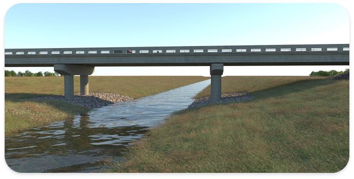
Our infrastructure project will create new trails, aqueduct access points, and outdoor spaces, providing people in the FMWF area with more opportunities to enjoy nature and experience the associated health and wellness benefits.
We prioritize education by offering school field trips, classroom presentations, internships, and apprenticeships, providing valuable learning opportunities for students of all ages and disciplines, including engineering, environmental studies, and business.
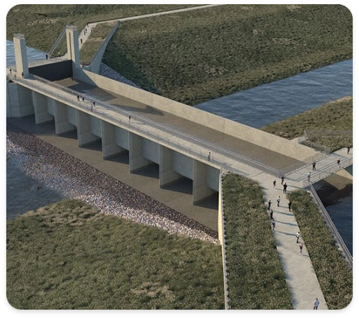
The diversion project will position the FMWF area as home to one of the world’s greatest infrastructure projects, attracting tourism from engineering enthusiasts and fostering eco-tourism, thereby enhancing the area’s global reputation.
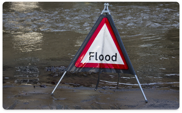
With the diversion, the FMWF area will become an even more desirable location for relocation, offering increased protection against flooding, accessible parks for residential neighborhoods, and enhanced long-term prospects for home values, job opportunities, and overall quality of life.